South Carson Street.
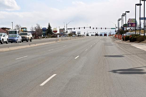
The Board of Supervisors approved the ongoing design of the South Carson Street project, now 60 percent complete.
The design was presented to the Regional Transportation Commission in March and to the public at an open house in April, and there have been several changes to it since the 30 percent milestone, some based on feedback from the RTC and public.
The roundabout at Carson and Stewart streets, for example, is now being designed with two lanes similar to the roundabout at Kietzke Lane and Neil Road in Reno. A southbound pass lane to remain outside the roundabout has been changed, too, in order to accommodate a future connection to Curry Street through the U.S. Forest Service property, which is now expected to happen.
“Are there enough right-hand turn pockets?” asked Supervisor Stacey Giomi, who cited current back ups at the right turn into Raley’s grocery.
Dan Stucky, city engineer, said Public Works had hired an independent consultant to study that and the design reflected the consultant’s recommendations. Northbound, there are right-hand turn lanes at Snyder Avenue, Clearview Drive, Eagle Station Lane, Fairview Drive, and 5th Street. Southbound, right-hand turn lanes are at Rhodes Street, Eagle Station Lane, and Appion Way.
The board also discussed the rights-of-way along Carson Street, which the city took over from the Nevada Department of Transportation and which many businesses along the route leased from NDOT. The city is continuing to lease or provide encroachment permits for their use and wants to retain them through the road’s reconstruction to ensure the project has the land it needs. After that, the city will consider each right of way separately and make a policy decision whether to lease, sell, or issue encroachment permits.
“I get this question a lot: why are we reducing lanes? We’re not giving up any land, right? We are creating a multiuse path out of what was a lane and we could expand in the future if we needed to,” said Giomi.
Stucky said the city wasn’t giving up any land, and the project was based on a projected 40 percent reduction in traffic once the I-580 bypass went in, and traffic has dropped by more than 50 percent, from roughly 45,000 vehicles daily to 20,000.
He said the road as currently designed will be akin to William Street between Saliman Road and Carson Street, which is two lanes in each direction with a center turn lane and about 26,000 vehicles daily. Stucky also said the design returns South Carson Street to five lanes — two in each direction and center turn lane — as it was before it was expanded by NDOT. In 2001, for example, he said the five-lane road handled 43,500 vehicles daily.
The design will come back to the board for approval this summer when it’s 90 percent done. The design is expected to be completed by September.
The board also sent a 10-year, $5.1 million agreement with NDOT back to staff for additional work.
The agreement would provide the city use of the Statewide Public Safety Radio Communications System, which is used by state organizations such as Nevada Highway Patrol as well as by Washoe County.
James Jacklett, operations manager, control systems, said using the statewide system would be more expensive but provide better coverage, and migrate the city off its current legacy system, which comes with its own costs to maintain.
Supervisor Brad Bonkowski said he estimated it would cost $870,000 more each year to operate.
“We need to work out the money side,” he said.
The radio system is used by law enforcement, the fire department, and Public Works, which cover the costs of their portion of use.
Fire Chief Sean Slamon and Sheriff Ken Furlong both said they supported the move to the statewide system.
“Our system is maxed out, we struggle to meet our needs,” said Slamon. “I believe it is our best option. It’s expensive but both options have a cost.”
-->The Board of Supervisors approved the ongoing design of the South Carson Street project, now 60 percent complete.
The design was presented to the Regional Transportation Commission in March and to the public at an open house in April, and there have been several changes to it since the 30 percent milestone, some based on feedback from the RTC and public.
The roundabout at Carson and Stewart streets, for example, is now being designed with two lanes similar to the roundabout at Kietzke Lane and Neil Road in Reno. A southbound pass lane to remain outside the roundabout has been changed, too, in order to accommodate a future connection to Curry Street through the U.S. Forest Service property, which is now expected to happen.
“Are there enough right-hand turn pockets?” asked Supervisor Stacey Giomi, who cited current back ups at the right turn into Raley’s grocery.
Dan Stucky, city engineer, said Public Works had hired an independent consultant to study that and the design reflected the consultant’s recommendations. Northbound, there are right-hand turn lanes at Snyder Avenue, Clearview Drive, Eagle Station Lane, Fairview Drive, and 5th Street. Southbound, right-hand turn lanes are at Rhodes Street, Eagle Station Lane, and Appion Way.
The board also discussed the rights-of-way along Carson Street, which the city took over from the Nevada Department of Transportation and which many businesses along the route leased from NDOT. The city is continuing to lease or provide encroachment permits for their use and wants to retain them through the road’s reconstruction to ensure the project has the land it needs. After that, the city will consider each right of way separately and make a policy decision whether to lease, sell, or issue encroachment permits.
“I get this question a lot: why are we reducing lanes? We’re not giving up any land, right? We are creating a multiuse path out of what was a lane and we could expand in the future if we needed to,” said Giomi.
Stucky said the city wasn’t giving up any land, and the project was based on a projected 40 percent reduction in traffic once the I-580 bypass went in, and traffic has dropped by more than 50 percent, from roughly 45,000 vehicles daily to 20,000.
He said the road as currently designed will be akin to William Street between Saliman Road and Carson Street, which is two lanes in each direction with a center turn lane and about 26,000 vehicles daily. Stucky also said the design returns South Carson Street to five lanes — two in each direction and center turn lane — as it was before it was expanded by NDOT. In 2001, for example, he said the five-lane road handled 43,500 vehicles daily.
The design will come back to the board for approval this summer when it’s 90 percent done. The design is expected to be completed by September.
The board also sent a 10-year, $5.1 million agreement with NDOT back to staff for additional work.
The agreement would provide the city use of the Statewide Public Safety Radio Communications System, which is used by state organizations such as Nevada Highway Patrol as well as by Washoe County.
James Jacklett, operations manager, control systems, said using the statewide system would be more expensive but provide better coverage, and migrate the city off its current legacy system, which comes with its own costs to maintain.
Supervisor Brad Bonkowski said he estimated it would cost $870,000 more each year to operate.
“We need to work out the money side,” he said.
The radio system is used by law enforcement, the fire department, and Public Works, which cover the costs of their portion of use.
Fire Chief Sean Slamon and Sheriff Ken Furlong both said they supported the move to the statewide system.
“Our system is maxed out, we struggle to meet our needs,” said Slamon. “I believe it is our best option. It’s expensive but both options have a cost.”