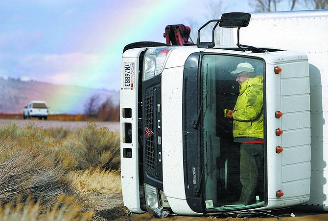
Chad Lundquist/Nevada Appeal Michael Irwin, a Capital Towing employee, works on the inside of the cab of a large truck that overturned in the southbound lanes of Highway 395 in Washoe Valley. High winds caused the Nevada Highway Patrol to close the highway to trucks and campers most of Monday afternoon.
Strong winds that blew through the region Monday were expected to taper off early this morning, according to the National Weather Service.
Brief electricity interruptions occurred around Carson City during the early evening. These outages were attributed to power lines striking one another or debris falling on the lines, such as tree branches, said Karl Walquist, a spokesman for Sierra Pacific.
The city's emergency response dispatch center was flooded with calls from concerned residents.
The National Weather Service warned of winds 35 to 40 mph with gusts reaching 70 mph Monday and very early today. More wind is predicted for Thursday.
High-profile vehicles and trailers were prohibited on Highway 395 and advised to use State Route 429 until the winds subsided. One large truck overturned on the southbound side of the highway in the early afternoon, requiring the traffic be routed into one lane until the truck was removed.
SR429 is "closer to the base of the mountains, where the wind isn't so strong," said Trooper Chuck Allen, Nevada Highway Patrol.
"High-profile passenger vehicles are susceptible to feeling those strong winds," Allen said. "Drivers need to keep both hands on the steering wheel."
It's also important for all drivers to be aware of the traffic around them because vehicles could be blown over separating lines and into neighboring lanes when the wind is strong.
Thoughts already have turned to winter after high-elevation areas received their first big dustings of snow during the weekend. Mount Rose received five to 10 inches of snow, said Wendell Hohmann, a forecaster with the weather service office in Reno.
Lower elevations, including Carson City, received rain.
"This area can see snow in October," Hohmann said. "It was a pretty warm summer, and suddenly here we are in the 20s and 30s with a lot of wind. It's a change."
Sales and installations of snow tires have jumped now that winter seems to have arrived, said Manny Castrellon, assistant manager of Les Schwab Tires on South Carson Street.
"It kind of woke everybody up," Castrellon said of the weather. "They said 'It's time to do this.'"
While people could start driving around the region on studded tires as of Oct. 1, it's not necessarily a good idea to use them until there is snow on the ground, he said.
"Without snow, the tire melts away," he said.
With the cold weather - snow or no - it's important for people to check the air pressure level in their tires and to make sure their treads are sufficient, Castrellon emphasized.
City employees are preparing for winter, too. Seven new snowplows are being prepared for eventual duty, and workers are practicing their driving techniques for when the streets need to be cleared of snow.
Monday also was the start of final garden and yard debris pick ups. The last day for this type of waste to be taken away by the city is Friday.
Keeping leaves out of the street and the drains open is important because it will help keep the storm drains working properly. Winter spot flooding occurs when the drains are backed up, said Ken Arnold, senior public works operations chief.
"Don't throw leaves down the drains," he warned. "Bag them up."
Call Public Works at 887-2355 for details about the garden waste pick ups.
• Contact reporter Terri Harber at tharber@nevadaappeal.com or 882-2111, ext. 215.

Comments
Use the comment form below to begin a discussion about this content.
Sign in to comment