Fast Facts
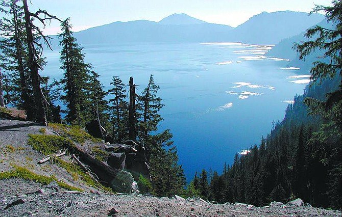
Crater Lake in Oregon rests in the shattered remnants of Mount Mazama. The volcano erupted and the mountain collapsed about 7,700 years ago.
Discovered: June 12, 1853, by John Wesley Hilman who was looking for the Lost Cabin Mine with a party of gold seekers.
National Park: Crater Lake, the nation's sixth national park, earned its designation May 22, 1902.
The lake
Crater Lake is the nation's deepest lake. Springs, rain and snow began to accumulate on the caldera floor when the magma cooled about 5,000 years ago.
Max. depth of lake: 1,943 feet
Avg. depth: 1,148 feet
Max. width: 6 miles
Lake surface elevation: 6,173 feet above sea level
Wizard Island elevation: 6,940
Wizard Island height above water: 767 feet
The Rim
Rim drive is a 33-mile route that circles the caldera rim.
Hilman Peak (highest point on rim): 8,151
Mount Scott (highest point in park): 8,929
Union Peak: 7,709
Average precipitation: 66 inches
Average annual snowfall: 44 inches
Max. snow depth: 21 feet
Park size: 183,225 acres
Information
Call the park office at (541) 594-3000
On the Net: http://www.nps.gov/crla
Get there
Crater Lake is in the southwestern portion of Oregon. To get there take Interstate 5 to Medford and follow State Route 62 to the lake or take State Route 62 from Klamath Falls.
Our ride
Not the most direct route, loads of twisting roads, two days:
Day One: Reno to Chico take California State Route 70; Chico to Weaverville take SR99, to SR36 to Highway 3
Day two: Weaverville to Shady Cove take Highway 3 to Interstate 5 to SR 62

Comments
Use the comment form below to begin a discussion about this content.
Sign in to comment