Seth Lightcap/Sierra Sun
KINGS BEACH - More than 40 people attended a public discussion here to take part in the Regional Transportation Plan update, and it's likely that most of the participants drove themselves to the North Tahoe Community Conference Center.
Each participant was given a walkability score at the meeting, which is based on the proximity of their residence to basic services. The number, ranging from zero to 100, roughly indicates how easy it is to get around on foot.
Only 12 participants received a score above 50, the lowest possible walkable rating. The remaining 30 participants live in neighborhoods within walking range of only a few destinations, or none at all.
After participants adjusted their score to factor in such issues as weather conditions, safety and topography, only three people kept their ratings above 50.
With small communities scattered along a linear highway that wraps around the lake, encouraging alternative forms of transportation is a challenge in the Tahoe Basin, said Darin Dinsmore, with Regional Planning Partners, who is coordinating the public outreach for the transportation plan.
"If [transit] is not convenient, we will never reduce our dependence on the automobile," Dinsmore said following the public meeting on Tuesday.
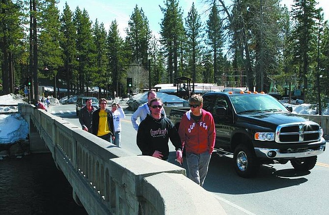
Tahoe's urban centers, however, rate fairly high on the walkability scale, Dinsmore said.
So the solution must focus on diversifying mobility options within the urban center- building sidewalks and bike paths, and keeping them accessible in the winter - while at the same time, improving transit services that connect to the outlying areas and neighborhoods, Dinsmore said.
Scheduled for adoption this summer, the Regional Transportation Plan will take a comprehensive look at transit in Tahoe, including infrastructure, redevelopment proposals, land use, boosting existing services and diversifying transit options. The transportation plan, developed by the Tahoe Metropolitan Planning Organization, was last updated in 2004.
One of the primary goals of Basin agencies is to reduce dependence on the automobile.
Lowering vehicle-miles-traveled will accelerate the attainment of the Tahoe Regional Planning Agency's environmental thresholds, or goals, for air quality and water quality, said Dennis Oliver, TRPA spokesperson.
"It just provides a blueprint for what your priorities are when you go out to seek funding," Oliver said, noting that the transportation plan won't get proposed transit projects on the ground until the funding comes together.
While federal, state and local resources all contribute to transportation projects, Keith Norberg, TRPA transportation representative, predicted at Tuesday's meeting that state and federal deficits will transfer more financial responsibility for transportation to local jurisdictions.
There is talk about establishing a regional transit authority, Oliver said. And local jurisdictions may need to raise money, possibly by passing a county transportation sales tax, to leverage state and federal funds, he said.
"We've gotten to the stage with some of these projects where we've got to figure out a way to actually deliver them," Oliver said. "You can't just talk forever about solving the transportation problems. Talk can only go so far. Meanwhile, traffic backs up."
What makes a neighborhood walkable?
• They have a discernible center, such as a shopping district, a main street or a public space.
• The neighborhood is dense enough for local businesses to flourish and for public transportation to be cost-effective.
• Housing is provided for everyone who works in the neighborhood, including the young and old, singles and families, rich and poor.
• There are plenty of parks and public places for people to gather.
• The neighborhood is accessible to everyone, including wheelchair access. It should have plenty of benches with shade and sidewalks.
• Streets are well-connected and improve traffic by providing many routes to any destination.
• Buildings are designed with pedestrians in mind. They should be placed close to the street to cater to foot traffic.
• Residences should be close enough to schools and workplaces so people can walk from their homes.
Source: www.walkscore.com

Comments
Use the comment form below to begin a discussion about this content.
Sign in to comment