Amy Lisenbe/Nevada Appeal
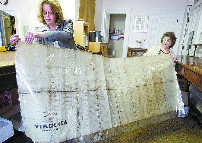
A copy of an old map could clear up a difference of opinion that started in the mid-19th century about where Virginia City ends and Bureau of Land Management property begins.
Jon Bunch, chief right-of-way agent for the Nevada Department of Transportation, said someone at his office located the map while doing research.
"We have a lot of records at NDOT and I'm not sure exactly who found it but at some point in time we came to the realization it was a map that Storey County did not have," he said.
So Bunch took a copy of the approximately 2-feet-by-6-feet map, encased it in plastic, rolled it up and gave it to Storey County Recorder Sarah Jensen.
"I was very surprised that BLM had something like this," she said.
One reason for surprise is that there has been a long dispute between county and federal officials about where limits to the townsite were.
Dean Haymore, Storey County Building and Planning officer, said the county was working with the BLM to try to settle this "hiccup."
He said BLM has contended that the southern half of Virginia City was federal land, and the northern part from Washington Street was privately owned.
"I've been working on it for years," he said.
Haymore said BLM is willing to work with the county to straighten out the matter.
"We have a good relationship with BLM to try to get it all resolved," he said.
In some instances property titles have been clouded because of the dispute, and a resolution could aid property owners. Ron James, State Historic Preservation Officer, called it "interesting" that the map has appeared now.
He said historically there were only two ways to have federal land transferred from federal management to private holders in the mining West: have a patented mining claim, which gave mining companies ownership of the real estate; or file a town plat, which would transfer the ownership from federal to local management and then to private holders.
"Allegedly the 1865 plat map was never submitted by Virginia City to the Department of the Interior," he said.
James said the find proves that the local government did in fact submit the plat map.
"It does suggest the local government acted in good faith to obtain the management and therefore local ownership of the town of Virginia City," he said.
The map is in good condition, with a few frayed edges and only a few areas of text difficult to read.
All street names are hand-printed and the accompanying text, which indicates time and place recorded, is done in longhand, indicating the map was approved by Mayor George Jones and the board of aldermen of the town of Virginia. It was recorded by City Clerk William Gillespie on Aug. 17, 1865, and by Storey County Clerk H.M. Vesey on Oct. 25, 1865.
It shows streets, squares, and blocks, and includes a scale and compass.
The town's lettered streets range from A to P, one less than exists today, and streets that one won't find on one of today's maps, such as Johnson, Calrow, Mason, North and Noyes. Jensen said many streets have been abandoned over the years.
It also contains sworn testimony of two citizens, Henry Dd. Smith and John Piper, of Piper's Opera House fame, attesting that they had been residents for four years and the city of 4,000 inhabitants was founded in good faith and not for speculation purposes.
The map was submitted to the U.S. Department of the Interiors General Land office in 1876 and states that it is "properly recorded establishment of the townsite on public lands."
Bunch said NDOT probably had the map for more than 50 years, and didn't know how the state agency came into possession.
Jensen plans to take the map to the state demographer to be scanned.
• Contact reporter Karen Woodmansee at kwoodmansee@nevadaappeal.com or call 881-7351.

Comments
Use the comment form below to begin a discussion about this content.
Sign in to comment