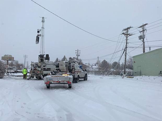
This photo courtesy of Erick Studenicka shows downed power lines during Sunday's snow storm.
With rain in the forecast, Carson City is bracing for the possibility of flooding.
With snow and ice still on the ground and rain in the forecast, Carson City Public Works deputy director Curtis Horton said that could cause some flooding in the area.
“I think we’re going to see localized flooding in most of the intersections,” Horton said. “We’ll address those as we proceed. Our concern mainly is localized runoff and minimizing the localized runoff.”
Horton said the city has brought in sandbags to deal with possible flooding. Sandbag filling stations are also available for the public at the corporate yard, 3505 Butti Way; Winnie Lane and Foothill Drive; Ross Gold Park, 280 Appion Way; and Fire Station No. 52, 2400 E. College Parkway.
For Carson City a high wind watch will go into effect from 10 a.m. Thursday until 4 a.m. Friday. The forecast for Carson City calls for as much as a quarter to a half inch of rain in Carson City Wednesday.
There’s a chance of rain and snow on Thursday with a chance of as much of an inch of snow on Thursday night. The forecast calls for a chance of snow showers throughout the weekend. Today’s and Thursday’s high is expected to be 46.
Carson City Public Works issued the following statement:
“The National Weather Service is forecasting a strong wet winter storm event which may impact the Carson City area from Wednesday to Thursday. Recent storms left many storm drains blocked by snow. Storm preparation efforts are underway, Carson City Public Works crews are currently assessing drain inlets, opening storm drains, and plowing the streets.”
For storm updates and information, visit carson.org/alerts. Those who need assistance can call 775-887-2355.
On Tuesday night, the forecast called for an 80 percent chance of snow at the lake level at Lake Tahoe and then a 100 percent chance of rain and snow Wednesday. But then the forecast calls for a 90 percent chance of just rain at the lake level Wednesday night.
The forecast calls for continued rain at the lake level on Thursday before 1 p.m., then rain and snow on Thursday afternoon and then just snow Thursday night. The forecast then calls for a chance of snow showers throughout the weekend at lake level.
Wind gusts could reach as high as 60 mph at lake level on Thursday, the National Weather Service forecast stated. A winter storm warning takes effect at 10 p.m. Tuesday and will remain in effect through 10 p.m. Thursday in the Sierra Nevada.
With rain predicted in higher elevations, Lyon County is also taking precautions for possible flash flooding. Lyon County crews are establishing self fill sandbag stations at the following locations: Silver Springs Animal Control Yard East of Ramsey Weeks; Stagecoach Community Center on Highway 50; outside of gate at 200 Lakes Blvd. Road/Utlities Yard; Fire Statin on Red Rock Road in Mound House; and Silver City Community Center.

Comments
Use the comment form below to begin a discussion about this content.
Sign in to comment