Western Nevada could see its first snow of the season Tuesday in a weather system heralded by high winds, the National Weather Service said.
A wind advisory is in effect Tuesday from 11 a.m. to 8 p.m. Southwest winds 20 to 30 mph with gusts up to 50 mph are expected, according to the NWS statement posted at weather.gov. In wind prone areas gusts could reach 65 mph.
“Tree limbs could be blown down and a few power outages may result,” the statement said. “The peak of the wind speeds will be in the afternoon and early evening hours.”
In a separate statement, the NWS the “first impactful snowfall of the season” will arrive with this storm.
“Early in the day Tuesday, precipitation will likely start out as snow above 6,000 feet as the main band pushes into northwestern Nevada,” the NWS said. “Rain or a rain/snow mix will be possible below this elevation. While snow levels may rise close to 7,000 feet Tuesday afternoon, they will fall to valley floors by Wednesday morning. Snow showers may continue to impact roadways through early Thursday morning.”
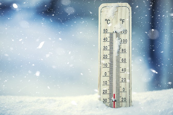
Temperatures are forecast to drop later in the week.
“High temperatures will plummet some 15-20 degrees below average on Wednesday and Thursday – struggling to get out of the 30s in the Sierra valleys and 40s across western Nevada.
“Hard freezes are likely, particularly Thursday and Friday mornings as skies clear out.”
THE FORECAST
Monday night: Mostly cloudy, with a low around 36. Southeast wind around 5 mph becoming southwest in the evening.
Tuesday: Rain, mainly after 11 a.m. Snow level 6,500 feet. High near 58. Windy, with a southwest wind 5 to 15 mph increasing to 20 to 30 mph in the afternoon. Winds could gust as high as 45 mph. Chance of precipitation is 90%.
Tuesday night: Rain likely before 8 p.m., then snow showers likely. Mostly cloudy, with a low around 21. Breezy, with a southwest wind 20 to 25 mph decreasing to 10 to 15 mph after midnight. Winds could gust as high as 40 mph. Chance of precipitation is 70%. New snow accumulation of less than a half inch possible.
Wednesday: A 30 percent chance of snow showers, mainly after 11 a.m. Partly sunny, with a high near 43. West wind 5 to 15 mph. Little or no snow accumulation expected.
Wednesday night: A 20 percent chance of snow showers before 11 p.m. Mostly cloudy, with a low around 17. West wind 5 to 10 mph becoming light in the evening.
Thursday: Mostly sunny, with a high near 41.
Thursday night: Mostly clear, with a low around 18.
Friday: Mostly sunny, with a high near 55.
Friday night: Partly cloudy, with a low around 30.
Saturday: A slight chance of rain. Snow level 7,200 feet rising to 8,600 feet in the afternoon. Mostly sunny, with a high near 60.
Saturday night: A chance of rain. Mostly cloudy, with a low around 35.
Sunday: A chance of rain. Snow level 7,700 feet. Partly sunny, with a high near 57.