Western Nevada College officials have decided to delay the opening of the Carson City campus, including the Child Development Center (CDC), and the Fallon campus on Thursday, Jan. 11.
The Carson City and Fallon campuses and the CDC will begin operations at 10 a.m. because of adverse road conditions.
For updates and more information about WNC, go to wnc.edu.
•••
Due to the winter weather advisory, expected high winds and pending weather-related conditions, all after-school activities including student programs and practices are canceled today, January 10, 2024. This includes Capital Kids and all athletic practices, clubs, academic programming and/or sports contest/scrimmages. Boys and Girls Club will remain open this evening, but parents are asked to pick up their child(ren) as early as possible.
School buses will operate on the regular release schedule this afternoon. If you normally pick up your child after school, please be there promptly at their dismissal. All activities in or outside of all school and district buildings are canceled this evening. The buildings and parking areas will be closed to ensure successful snow removal.
Additionally, with tomorrow morning's temperature forecast to be 14 degrees at 7 a.m., it is expected that any accumulation received throughout the evening may create icy and treacherous driving conditions. Therefore, all Carson City School District schools will observe a delayed 2-hour schedule Thursday, January 11, 2024.
Tomorrow, buses will operate on a 2-hour delay, so arrival times will be approximately 2-hours later than usual. There will be no Pre-School and Early Childhood classes or breakfast served at school Thursday, Jan. 11, 2024.
Employees are to report to work at least 15 minutes before, but not more than 30 minutes before student instruction begins and as specified in their regular assignment to allow time to prepare safe parking lots and walkways. They should take caution and plan 2-times their normal travel time depending on driving conditions.
It is anticipated Thursday’s school day will end at the regular time. Please have students wear appropriate clothing and footwear for cold and wet weather. Please stay tuned to local media and the district’s website at carsoncityschools.com for updates. Click here for more information about weather-related school closures.
•••
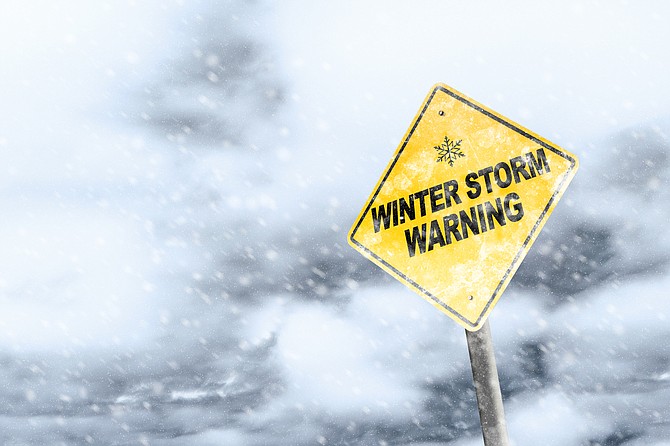
A winter weather advisory is in effect from 4 a.m. to 10 p.m. Wednesday, according to the National Weather Service in Reno.
Gusty winds and snow accumulations on valley floors between 2 and 6 inches are expected.
Winds are expected to gust up to 40-55 mph. In wind prone areas, gusts are expected to be 60-75 mph.
“Plan on slippery road conditions,” the advisory says. “The hazardous conditions could impact the Wednesday evening commute. Strong winds could cause damage to trees and power lines. Sudden reductions in visibilities of less than a 1/4 mile with whiteout conditions possible.”
The latest road conditions can be obtained by calling 511 or by visiting nvroads.com.
“This event will be similar to the event observed this past Saturday,” the advisory says. “Enhanced snow bands accompanying a cold front will bring quick, heavy snowfall in a short period with locally heavier amounts possible if these bands stall. With these bands expected to pass through during the peak school/work commute time, major travel disruptions are possible. Very cold temperatures behind the front may lead to flash freezes on roadways and prolonged hazardous travel conditions into the Thursday morning commute.”
FORECAST
Wednesday: Snow, mainly after 11am. High near 40. Windy, with a southwest wind 30 to 35 mph, with gusts as high as 55 mph. Chance of precipitation is 80%. New snow accumulation of less than a half inch possible.
Wednesday Night: Snow likely, mainly before 11pm. Mostly cloudy, then gradually becoming mostly clear, with a low around 11. Breezy, with a west wind 15 to 20 mph becoming north 10 to 15 mph after midnight. Winds could gust as high as 30 mph. Chance of precipitation is 70%. New snow accumulation of 1 to 3 inches possible..
Thursday: Sunny, with a high near 34. Calm wind becoming west around 5 mph in the afternoon.
Thursday Night: Mostly cloudy, with a low around 19. West wind around 5 mph.
Friday: A slight chance of rain and snow after 5 p.m. Partly sunny, with a high near 43. West wind around 10 mph, with gusts as high as 20 mph. Chance of precipitation is 10%.
Friday Night: A slight chance of rain and snow before 8 p.m., then a chance of snow between 8pm and 5am, then a chance of rain and snow after 5 a.m. Mostly cloudy, with a low around 28. Chance of precipitation is 30%. Little or no snow accumulation expected.
Saturday: A chance of rain and snow before 11 a.m., then rain likely. Snow level 5200 feet rising to 6200 feet in the afternoon. Mostly cloudy, with a high near 44.
Saturday Night: A chance of rain and snow, mainly before 11 p.m. Snow level 5200 feet. Mostly cloudy, with a low around 22.

Comments
Use the comment form below to begin a discussion about this content.
Sign in to comment