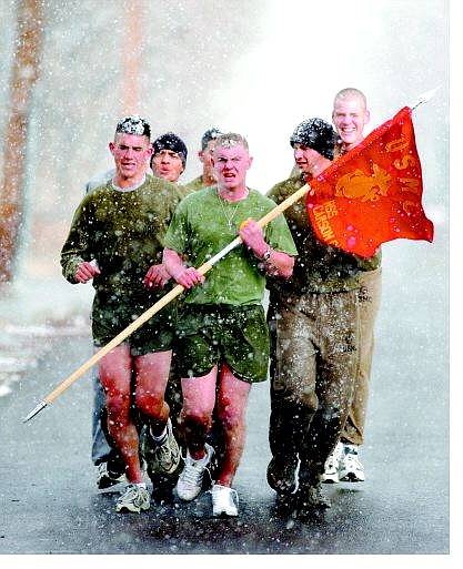
Brad Horn/Nevada Appeal Pvt. Sean Smith, from left, Pfc. Vicente Coronado, Lance Cpl. Michael DeWitt with flag, Pvt. Jason Hayes and Pvt. Kevin Brown brave snowy conditions to jog on Roop Street in Carson City on Wednesday. The Marines are on a 10-day leave.
Even with satellites and computers, the National Weather Service rarely calls its forecasts a sure thing.
Unfortunately for those with New Year's travel plans, the next few days is one of those times. The weather service Web site says flatly the forecast for today and Friday is "Definite Snow" all the way to the valley floor, accompanied by stiff winds.
According to meteorologist Brian O'Hara, the storm was expected to arrive over western Nevada last night and then "just sort of sit over us."
That means four or five inches in the valleys from Reno to Carson City and Minden-Gardnerville today and a similar amount Friday with more - possibly much more - at Lake Tahoe and in the higher elevations. He said showers are expected to continue through the weekend.
At least until tonight, he said, the storm will most likely include stiff winds - 20-30 mph in the valleys with gusts up to 50 mph.
And that, naturally, means tough driving conditions with slippery roads and limited visibility.
"There could be blizzard and white-out conditions with gusts to 80 over the ridges and 60 through the passes," O'Hara said. "It could be quite dangerous traveling over the next couple of days. If you can postpone travel, do."
Although the storm originated in the Gulf of Alaska, O'Hara said, temperatures shouldn't be too severe - rising from the low 20s overnight to the mid and upper 30s today, Friday and Saturday. In fact, the predicted high for Reno and Carson City both today and Friday is in the 40s.
Saturday's projected high is 39 degrees.
But that "definite snow" forecast will remain in place until New Year's Day and, even then, forecasters say they see a good chance for showers Sunday.
But, O'Hara said, the winds should fade Friday to 10-15 mph.
Skiers should enjoy the aftermath with resorts expected to get up to three feet of white stuff in many areas - even more at higher elevations.
Contact reporter Geoff Dornan at nevadaappeal@sbcglobal.net or 687-8750.

Comments
Use the comment form below to begin a discussion about this content.
Sign in to comment