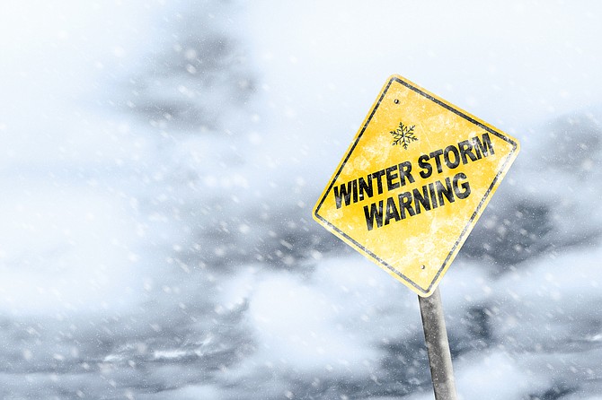
Carson City could receive as much as 8 inches of snow from a storm expected to move into the area starting Thursday, the National Weather Service said.
“Even by Sierra standards, this is shaping up to be a highly impactful major storm,” NWS Reno meteorologist Tony Fuentes told The Record-Courier. “If these snow totals hold this will easily be the biggest storm of the season.”
Just ahead of the storm, all of western Nevada is under a high wind watch from late Wednesday through Thursday evening, the NWS said at weather.gov. Southwest winds 40 to 50 mph are expected, with gusts up to 75 mph.
Following the high wind watch, a winter storm watch is in effect from Thursday evening through Saturday morning.
“Heavy snow likely,” the NWS said. “Snow accumulations up to 8 inches for valley floors in Reno, Carson City, and Carson Valley with 1 to 2 feet for Virginia City, the Virginia Highlands, and foothills above 5,000 feet. Winds gusting as high as 70 mph.
“Travel could be very difficult to impossible due to heavy snow and whiteout conditions. Strong winds could cause damage to trees and power lines.”
Nevada road conditions are available at www.nvroads.com.
California road conditions are available at cwwp2.dot.ca.gov/vm/iframemap.htm.
THE FORECAST
Wednesday: Sunny, with a high near 58. Light and variable wind becoming southwest 5 to 10 mph in the morning.
Wednesday night: Partly cloudy, with a low around 36. Southwest wind 10 to 15 mph.
Thursday: A 30 percent chance of rain after 10 a.m. Snow level 6,000 feet. Partly sunny, with a high near 52. Windy, with a southwest wind 15 to 25 mph increasing to 25 to 35 mph in the afternoon. Winds could gust as high as 50 mph.
Thursday night: Rain likely before 4 a.m., then rain and snow likely. Snow level 5,700 feet. Mostly cloudy, with a low around 35. Windy, with a southwest wind around 30 mph, with gusts as high as 50 mph. Chance of precipitation is 70%. Little or no snow accumulation expected.
Friday: Rain and snow before 1 p.m., then rain between 1 p.m. and 4 p.m., then rain and snow after 4 p.m. Snow level 5,300 feet. High near 45. Breezy. Chance of precipitation is 80%. New snow accumulation of less than a half inch possible.
Friday night: Rain and snow, becoming all snow after 10 p.m. Patchy blowing snow after 11 p.m. Cloudy, with a low around 26. Breezy.
Saturday: Snow. Areas of blowing snow before noon. Mostly cloudy, with a high near 37. Breezy.
Saturday night: A chance of snow, mainly before 4 a.m. Mostly cloudy, with a low around 16.
Sunday: A slight chance of snow. Mostly sunny, with a high near 37.
Sunday night: Partly cloudy, with a low around 14.
Monday: Sunny, with a high near 41.